
Edouard Flooding in Texas Causes Outages: How Long Will It Last?

- Flooding from Edouard in Texas
- Rainfall totals reach 21 inches
- Edouard remains dangerous
The remnants of Edouard continued to pose a dangerous flooding threat across southeast Texas on Thursday, where torrential rain transformed roads and low-lying areas into high-risk zones.
The National Weather Service (NWS) issued a flash flood emergency for parts of Hardin and Tyler counties after extraordinary rainfall totals ranging from 10 to 21 inches were recorded.
The conditions prompted the Weather Prediction Center to maintain the highest level of excessive rainfall risk for parts of southeast Texas, particularly around Big Thicket and Piney Woods, because of potentially catastrophic flooding.
The danger did not end when Edouard weakened: Rain bands associated with its remnants continued affecting the region and could trigger additional flooding throughout Thursday.
Up to 21 Inches of Rain Make Edouard a Texas Threat
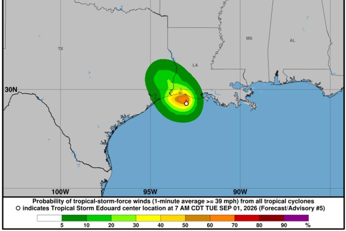
In Hardin and Tyler counties, authorities reported rainfall rates of up to 5 inches per hour, enough to rapidly raise streams and cover roads within minutes.
The NWS later reported that between 5 and 20 inches of rain had fallen in parts of Hardin, Jasper, and Tyler counties, with an additional 1 to 5 inches still possible.
YOU MAY BE INTERESTED IN: Nepal Floods: Death Toll Tops 1,000, Nearly 4,000 Missing
The agency specifically warned of life-threatening flooding on roads and streets, in low-lying and urban areas, along streams, and at other vulnerable locations.
The threat also extends to the Menard Creek basin, where the NWS forecast moderate flooding that could affect parts of Hardin, Polk, and Liberty counties.
Edouard Makes Landfall and Leaves Thousands Without Power
Edouard made landfall Tuesday near Johnson Bayou, Louisiana, as a tropical storm with maximum sustained winds of approximately 60 mph after strengthening while approaching the Gulf Coast.
Although the storm later weakened, its rainfall continued to pose the greatest danger to Texas, demonstrating that a cyclone’s loss of strength does not necessarily mean its threats have disappeared.
AccuWeather reported that more than 81,000 customers in Texas were without power by Wednesday night, while southeastern communities faced flooded streets and wind-related damage.
More than a dozen school districts, including those in Beaumont and Port Arthur, canceled classes while local authorities assessed road conditions, damage, and power outages.
How Long Will Flooding From Edouard Last?
The NWS had maintained a flood watch through Wednesday evening for Hardin, Jefferson, Orange, Jasper, Newton, and Tyler counties, warning that considerable and potentially catastrophic flooding remained possible.
Additionally, Edouard’s remnants were moving northwest and could extend the rainfall into the Brazos Valley, while some areas of Texas remained under watches through Thursday.
An immediate danger also remains on the roads: The NWS warns that drivers should never attempt to cross flooded areas, even when they appear passable.
Families in southeast Texas should prioritize following local alerts and avoiding unnecessary travel through flooded areas, as numerous roads remained closed Thursday, according to AccuWeather, ABC News, and the National Weather Service.
¿Te gustó este artículo? ¡Compártelo!
¡No te pierdas las noticias!
Suscríbete y recibe lo más importante directamente en tu correo
Artículos relacionados
Recomendado por IA
Residentes de Texas están avisados: Habrá inundaciones y cortes de luz por huracán Beryl

Tormentas eléctricas azotan el sur y este de EEUU: más lluvias, granizo y apagones hasta mitad de semana

Beryl toca tierra en Texas y deja sin luz a más de un millón

Impactantes imágenes de las inundaciones por fuertes lluvias en Texas

Tormentas severas afecta a millones en EEUU dejándolos sin electricidad

Comentarios 0
Sé el primero en comentar